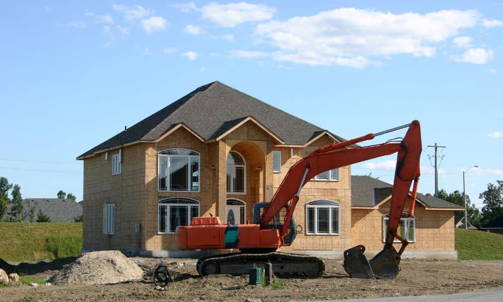
Colorado Springs is making big changes to its stormwater system, and these upgrades will shape how water moves across several busy areas. If you’re a homeowner or builder, you may already wonder whether these new projects could change how water drains around your property. This is where a topographic survey becomes important. It gives you a clear picture of your land’s elevation, slope, and drainage paths, so you can see if recent construction will impact your lot.
Over the past few days, the city and El Paso County shared updates about two major stormwater improvements. These projects may seem like simple “street work,” but they can change how water flows across yards, driveways, and even foundations. When the public right-of-way shifts, even by a few inches, nearby properties often feel the results.
Major Stormwater Projects Now Underway
El Paso County recently announced a large drainage project along North Gate Boulevard, between I-25 and Struthers Road. Crews are installing more than 3,000 feet of new stormwater pipes and building a new water-quality pond. While this may sound far from home, the area is growing fast, and many residential neighborhoods sit downhill from these upgrades. Any time the county changes how water collects or leaves a corridor, nearby properties may notice new flow patterns.
Colorado Springs is also starting storm drain and elevation improvements along North Stone Avenue. This project aims to reduce chronic flooding that has bothered residents for years. The upgrades include new inlets, improved slopes, and stronger drainage connections. These adjustments might look small from the street, yet they can shift water toward or away from nearby driveways and yards.
Both projects have been shared widely on city and county social media pages. Because of that, more people are asking how the work affects private property. And the truth is simple: any change to public drainage can change private drainage too.
How Public Stormwater Work Impacts Private Property
When a city regrades a street, adds a curb, installs a drain, or builds a pond, it changes where water goes. Water follows the lowest point, so a few inches of new slope can redirect it down a new path. This may create new surprises for homeowners.
One of the most common changes happens at driveways. If the street in front of your home gets a new inlet or a slightly different slope, the water that used to move across the road may now gather near the edge of your driveway. That often leads to puddles, winter ice, or slower drainage where none existed before.
Some homeowners also see new wet spots in their backyard. A new pond or outfall near a neighborhood may raise or lower groundwater levels. That can lead to soggy soil, softer ground, or pooling areas that were never there before. Sometimes this comes from offsite drainage that now redirects along a different path.
Side-yard swales can also change after public work. Most homes rely on shallow swales along property lines to carry water toward the street. If the street grade changes even a little, the swale may lose its pitch. When that happens, water stops moving and instead sits in unwanted spots.
These issues don’t appear everywhere, but when they do, the first clues usually show up on a topographic survey.
How a Topographic Survey Helps You See the Changes
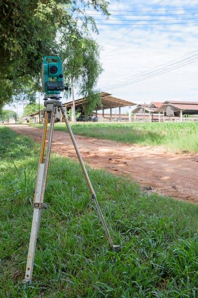
A topographic survey maps the elevations of your lot. It shows high points, low points, slopes, and the paths water follows when it rains. When stormwater projects change the area around your home, a topo is the tool that reveals whether the changes matter.
One major benefit is the ability to compare old and new elevations. If the road was changed, an updated topo shows whether water now flows toward your home instead of away from it. You can see the slope of your driveway, the drop from your garage to the street, and any grade changes near sidewalks or curbs.
A topo also highlights dips and depressions. If ponding now appears in areas that used to drain well, the survey points it out. This helps you fix problems before they turn into foundation issues or winter hazards.
Because a topo maps elevations along the sides and back of your property, you can see if swales still carry water in the right direction. If the grade is too flat or reversed, you’ll know why water is lingering.
Sometimes the fix is simple, such as regrading a small section to create a smooth path for water. But without the topo, you won’t know where the true problem lies. Many homeowners check in with a land survey company at this stage, not because they’re starting a big project, but because they want someone to double-check the elevations and explain what changed after the stormwater work.
What Homeowners Might Notice After Stormwater Projects Finish
Although every property is different, many homeowners begin to see signs that the recent work near North Gate Boulevard or North Stone Avenue may be affecting their lot. Some see new puddles at the base of their driveway. Others notice their yard stays wet longer after storms. A few notice new puddles forming near their foundation, even if the area was dry for years.
Water may also flow across parts of the yard that were always dry. Some people even see their sidewalk or driveway icing up more often in winter. In other cases, runoff may reach flower beds or landscaping in new ways.
If you see any of these changes, a topographic survey gives you clarity. Instead of guessing, you’ll have exact measurements of how your land slopes and where the water now wants to go.
When You Should Consider Getting a New Topographic Survey
You don’t need a new survey every year. However, you should get one when the land around your home or the public right-of-way changes. A fresh topo becomes valuable when your street or curb was graded, when a new storm inlet appears near your home, or when you notice new ponding.
You may also need a new one if you plan to rebuild your driveway or add new hardscaping. An updated topo is also smart when preparing plans for a contractor or engineer. In all these cases, having accurate elevations can save time and prevent costly mistakes.
Protecting Your Property Starts With Understanding It
Stormwater improvements help the city, but they sometimes create new challenges for nearby lots. A topographic survey helps you see these changes early so you can act before small problems become expensive repairs.
If you live or build, now is a smart time to review your property’s elevations. One updated topo can show you everything you need to know about how the city’s new drainage work affects your home.
