
Colorado Springs homeowners are on edge. After last week’s “unprecedented” flooding in southwestern Colorado, insurance companies are asking property owners to update their flood elevation certificate even if their homes weren’t touched by floodwater. Why? Because big storms can change floodplain maps and force new elevation checks across the state.
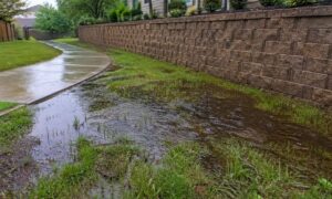
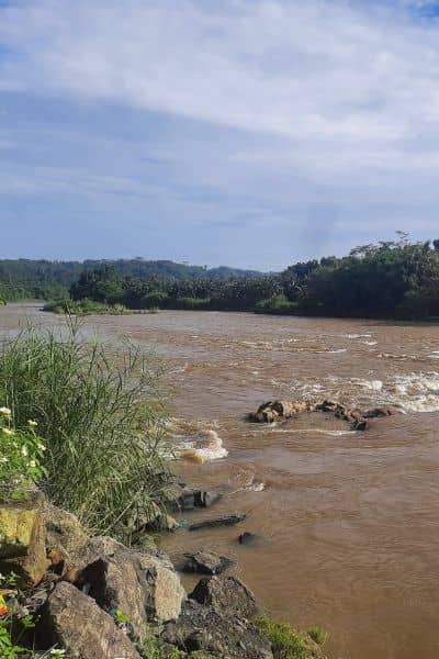
Heavy rain in Archuleta and La Plata counties pushed creeks to record levels, washed out roads, and shifted land corners. While those areas are hours away, what happens upstream or west of the Continental Divide can still affect Colorado Springs. When flood levels rise, insurance risk zones change—and that means local surveyors and homeowners now have more work to do.
When Storms Rewrite the Map
After large floods, FEMA and state agencies review floodplain boundaries and elevation benchmarks. These reviews can change a home’s risk category, which insurers use to set premiums. If your certificate was prepared before this month’s storm data, it may no longer match the new maps.
That’s why many residents near Fountain Creek, Monument Creek, and Cottonwood Creek are suddenly hearing from their insurance companies. They’re being asked to confirm that their certificates still reflect the right base flood elevation—or face higher rates and possible renewal delays.
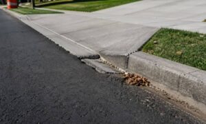
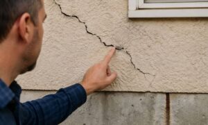
For surveyors, this is routine. Big storms reveal how much the land can shift, even by inches. A cracked driveway, sunken corner, or eroded yard can all affect the lowest adjacent grade listed on a flood certificate. Small changes like that can move a property from a moderate-risk zone to a high-risk one.
Why the Insurance Panic?
Insurance companies depend on accurate elevation data to judge flood risk. When new studies show higher water levels, they can’t rely on old numbers. A few feet of error could mean huge losses in potential claims.
For homeowners, this means a rush to update records. Waiting too long could lead to temporary coverage gaps or higher premiums. In some cases, old flood insurance discounts might disappear until a new survey confirms your current elevation.
Many people think once they have a certificate, it’s valid forever. It’s not. A flood elevation certificate can become outdated any time FEMA updates flood maps, benchmarks shift, or major storms reshape the ground. Insurers just need fresh proof that your home’s elevation still meets the latest standards.
How Surveyors Recheck Elevations After a Storm
When the land changes, even a little, licensed land surveyors step in to measure. It’s not just about holding a GPS rod—it’s about restoring confidence in the numbers that protect homeowners.
Here’s how surveyors in Colorado Springs handle post-storm rechecks:
- Benchmark checks: They find the nearest elevation control points, often within a few hundred feet of your property. They make sure those points weren’t damaged or moved by the storm.
- Level loop: Using precise leveling tools, they run checks between several benchmarks to confirm accuracy and catch any measurement errors.
- Building elevations: Surveyors measure the lowest adjacent grade, the finished floor, and the lowest opening of your home. These numbers are key for FEMA and insurance records.
- Photo proof: Clear photos show drainage lines, foundation corners, and elevation points—evidence that everything is current and verified.
All of this data builds an updated certificate that insurers can trust.
Colorado Springs Terrain Makes It Tougher
Surveying isn’t easy. The hills, sloped driveways, and uneven drainage areas make precise readings a challenge. That’s why surveyors use double checks and careful setups to make sure each reading is accurate. A single bad measurement—caused by soft soil or shaky tripods—can ruin an entire report.
Many crews now combine ground surveying with drone mapping to see small grade changes or erosion after storms. Aerial data helps verify that a property’s slope and drainage patterns haven’t shifted enough to need a full boundary or topographic survey.
When a Simple Update Becomes a Bigger Job
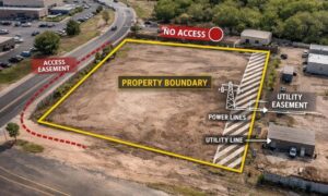
Sometimes a quick recheck turns into a bigger task. After heavy rain, fences, retaining walls, or creek banks might have moved. In those cases, surveyors may recommend a full boundary retracement or limited topographic survey. This confirms that property lines and drainage paths still match recorded plats.
For most homeowners, though, a short field visit is enough. The surveyor checks benchmarks, updates elevation points, and issues a revised flood elevation certificate in just a few days. That small update can save you from weeks of insurance delays.
What Homeowners Should Do Now
There’s no need to panic—but don’t wait too long either. Check the date on your current certificate. If it’s more than a year old or was created before the October 2025 floods, contact a licensed surveyor. They can tell you if your certificate needs updating.
Even if your house is far from a creek, runoff patterns can shift quickly after big storms. A few inches of ground movement can change your flood zone—and your insurance cost along with it.
If you’re refinancing or renewing a policy, an outdated certificate might delay the process or raise your premiums. A new one gives your insurer confidence in your actual flood risk—and sometimes lowers your rate.
Turning Panic Into Prevention
This fall’s floods are a reminder that elevation data isn’t permanent. Colorado’s weather can change fast, and keeping your documents updated isn’t just red tape—it’s peace of mind. Surveyors expect FEMA to recheck several state flood zones soon, so getting your revision now could save time later.
Think of your flood elevation certificate as a shield. It protects your property value, your insurance rate, and your ability to prove your home’s true elevation. It’s one small document that makes a big difference.
Final Thoughts
The storms may have hit hardest miles away, but their impact on insurance and property data reached all the way to Colorado Springs. Whether you’re a homeowner or developer, now’s the time to review your paperwork before the next storm season arrives.
If your insurer has asked for an update, don’t wait. Hire a licensed land surveyor who knows terrain and can deliver a precise, updated flood elevation certificate. Acting early helps you stay insured, compliant, and confident—no matter what weather brings next.