When the Hongqi Bridge in China collapsed only months after opening, the world reacted with shock. Videos spread online within hours, and people everywhere asked the same question: How does a brand-new bridge fail this fast? The answer points to something many people never think about geotechnical engineering. This part of civil engineering studies soil, rock, and the way the ground behaves under pressure. And in places like Colorado, where steep slopes, snowmelt, and sudden rainstorms shape the land, this work matters more than most people realize.
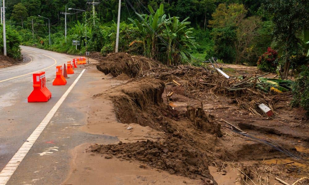
The Hongqi collapse became viral because the idea of “safe new infrastructure” suddenly didn’t feel so safe. Cracks showed up early. The surrounding hillside moved. After weeks of warnings, the slope finally gave way and ripped a section of the bridge apart. That failure wasn’t only a structural problem. It started deep in the ground.
Colorado faces similar terrain challenges. Our mountains are beautiful, but the geology under them never stops shifting. Because of that, geotechnical engineering protects everything from highways and bridges to hillside homes and retaining walls. And after watching Hongqi fall, it is easy to see why this work deserves more attention.
The Fast Story Behind the Hongqi Collapse
Just a few months after construction ended, the Hongqi Bridge started showing small cracks and strange movements along the nearby slope. Workers closed the bridge for safety. People noticed chunks of soil sliding down during rainstorms. Then one morning, the hillside pushed hard enough to tear through the bridge deck, sending large sections crashing into the river below.
That entire story unfolded on millions of screens within hours. However, behind the videos was something deeper: ground movement that no one stopped in time.
When slopes shift, they don’t care if a bridge is new or if it costs millions of dollars. Nature moves on its own schedule. That is why every responsible project in risky terrain needs strong geotechnical work from the very start.
Why Colorado Should Pay Attention
China is far away from Colorado, yet the lesson hits close to home. Colorado has its own history of rockfall, landslides, and soil shifts. If you drive on I-70 through the mountains, you already know how unstable the terrain can be. In some spots, the ground moves a little every year. Engineers work nonstop to keep the highways open because the mountains constantly push, slide, and crumble around them.
Even when the weather looks calm, the geology underneath keeps changing. Snowmelt soaks into the soil. Freeze-thaw cycles expand cracks in rock. Sudden storms build water pressure inside slopes. Because of all that, a safe project needs more than concrete and steel. It needs the kind of deep ground analysis that geotechnical engineers handle every day.
The Hongqi collapse wasn’t only a story about China. It reminded everyone that the ground under our feet can destroy even the strongest structure if we ignore the warning signs.
How Geotechnical Engineering Stops These Failures

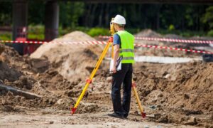
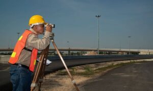
Modern geotechnical engineering begins with knowing the land. Engineers drill deep into the soil, study the rock layers, and measure how water moves underground. They check how slopes behave during rain, snowmelt, and earthquakes. Then they use that information to design foundations, supports, and drainage systems that fit the site.
In places like Denver and the Front Range, this work becomes even more important. Every hillside, canyon, and cut through a mountain creates risk. Because of that, engineers take extra steps to keep the ground stable before anything is built. They reinforce weak areas, improve drainage to relieve pressure, and secure slopes with rock bolts, soil nails, or retaining structures.
However, the job doesn’t end there. Conditions change every season, so engineers also design ways to keep watch. They install sensors that track slope movement. They recommend inspections after heavy storms. They study long-term patterns that help predict future risks. These steps make the difference between a safe bridge and a failure like Hongqi.
A Closer Look at Colorado’s Terrain Risks
Anyone who lives here knows Colorado weather changes fast. Yet the land shifts even faster, especially in high-risk areas. Because of that, Colorado’s Department of Transportation monitors more than a thousand geotechnical features across the state. Some slopes need attention every few months. Others stay stable for years and then move overnight after a big storm.
This constant motion means every project has to consider questions like:
- How will the soil behave during a wet spring?
- What happens when snow freezes and expands inside cracks?
- Could a storm increase groundwater pressure inside a slope?
- Will the hillside shift if new construction changes drainage paths?
These aren’t theoretical questions. They determine whether a project will stay solid for decades or fail under the pressure of moving ground. And the Hongqi collapse proved that ignoring the slope next to a bridge can be just as dangerous as ignoring the bridge itself.
What Clients Should Take Away From Hongqi
You don’t need to be an engineer to learn something important from that collapse. Anyone planning to build—whether it’s a bridge, a home, a subdivision, or a retaining wall—can take a few simple insights to heart.
First, never assume the ground is safe just because the structure above it looks strong. Soil and rock quietly shape every project. Second, always ask how your engineer plans to manage water. Almost every slope failure begins with trapped water, rising groundwater, or poor drainage. Third, understand how long-term conditions matter. A slope might hold steady for years and then shift suddenly after one heavy storm.
Because of that, your engineer should explain how they account for long-term movement, how they manage water pressure, and what kind of monitoring they recommend once construction ends. These conversations help prevent expensive failures later.
Why This Matters for Future Projects
Colorado continues to grow, and more development moves into areas with steep slopes, soft soils, and complex geology. Builders feel pressure to finish projects fast, but the Hongqi collapse shows why rushing can backfire. Real safety starts underground.
Strong geotechnical engineering reduces risk, protects investments, and gives clients peace of mind. It also saves money by catching problems early. When engineers understand the site from the beginning, they design better foundations, stronger supports, and smarter drainage systems. This keeps projects safe even when the ground shifts.
Final Thoughts
The fall of the Hongqi Bridge is more than a viral moment. It’s a reminder that nature always has the final say. However, Colorado doesn’t need to experience the same kind of failure. When geotechnical engineers take the time to study the land, reinforce slopes, and plan for long-term changes, they build projects that stay safe for generations.
If you’re planning construction —especially near slopes, drainages, or unstable ground—now is the best time to talk to a geotechnical expert. A strong design today prevents disasters tomorrow.


