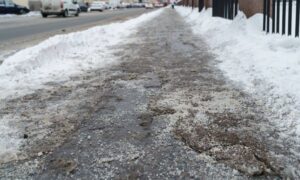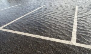
When the recent floods swept through parts of Colorado, including areas not far from Colorado Springs, they didn’t just leave muddy streets and damaged yards. They changed the ground itself. Creek banks shifted, low spots deepened, and drainage paths that never existed suddenly appeared. For many homeowners and property investors, that means one important thing: it’s time to look at your ALTA Land Title Survey again.
An ALTA Land Title Survey is more than a fancy property map—it’s a legal snapshot of what’s on your land and how it matches what’s on record. After a storm that reshapes the landscape, that snapshot may no longer tell the full story.
When Water Redraws the Lines
Floods don’t just wash away debris. They move earth, bend creeks, and even shift landmarks that once marked your boundary lines. In neighborhoods along Fountain Creek and Sand Creek, it’s not unusual for storm runoff to erode several feet of soil in a single night. When that happens, fences, corner pins, and visible landmarks can all move—sometimes just enough to create confusion later.
It’s easy to think, “My property lines haven’t changed; it’s still my land.” But legally speaking, water can alter more than you realize. A small shift in a bank or drainage ditch might affect a recorded setback, an easement, or a floodplain boundary. That’s where a new ALTA Land Title Survey becomes your best tool for certainty.
Why ALTA Surveys Matter After Major Weather Events
Most people only think about ordering a survey when buying or selling land. But heavy weather is another moment when it’s worth updating.
An ALTA Land Title Survey follows strict national standards. It verifies the boundaries, improvements, easements, and access points that define your property. After flooding, it’s the fastest way to confirm what’s changed—or what stayed the same.
Here’s how it protects you:
- It shows the real conditions now. Your old survey might have been perfect in 2018, but not after the creek jumped its banks.
- It supports insurance and rebuild claims. When you can show a before-and-after comparison, there’s less debate over where structures stood or what areas were affected.
- It keeps your title clean. If the land’s shape or elevation has shifted, your lender and title company need updated data before approving a refinance or sale.
Signs You Might Need a Post-Flood Survey
Even if your house stayed dry, your property may not be exactly the same as it was before. Watch for these signs:
- A fence, shed, or tree that now sits closer to the water than before.
- Missing survey pins or stakes along the property edge.
- New puddles or runoff patterns cutting across your lot.
- Neighbors dealing with boundary confusion after cleanup.
- Updated floodplain maps showing new risk zones in your area.
If any of these sound familiar, don’t wait until you’re refinancing or applying for permits. Updating your ALTA Land Title Survey early saves time and arguments later.
Checking Flood Maps the Smart Way

Before calling a surveyor, you can do a little homework yourself. Colorado’s Hazard Mapping and RiskMAP portal lets you see preliminary floodplain layers. Just enter your address and check whether your parcel sits inside a newly adjusted zone. You can also visit FEMA’s Map Service Center to download a FIRMette—an official flood insurance rate map panel for your property.
If your property now appears in a flood zone, don’t panic. An ALTA Land Title Survey can include accurate elevation data. From there, your surveyor can prepare an Elevation Certificate—a document that helps confirm whether your home is actually at risk or if it sits safely above the flood level. Sometimes, that one piece of proof can lower your insurance premium or even remove your property from the flood zone entirely.
Real Example: When a Creek Moves, So Does the Map
After a heavy storm last year, a small business owner near Fountain Creek noticed that the bank had eroded close to his fence line. He planned to rebuild but needed confirmation that the fence still sat within his property. His original 2016 survey no longer matched what he saw on the ground.
A new ALTA Land Title Survey showed the erosion had shifted the creek channel by nearly four feet. The updated data helped his engineer adjust the design of his retaining wall and ensured the rebuilt fence didn’t cross into the floodway. Because the survey also included elevation details, his insurer accepted the report for an updated policy. What could’ve become a boundary dispute turned into a clear, documented solution.
The Financial Payoff
Flooding brings enough stress without adding title issues or insurance confusion. A post-flood ALTA Land Title Survey is an investment that pays for itself in several ways:
- Fewer claim disputes: You’ll have a documented record of your land’s exact limits and elevations.
- Smoother refinancing: Lenders trust recent survey data, especially after natural disasters.
- Lower premiums: When paired with an updated Elevation Certificate, some property owners qualify for reduced flood insurance rates.
In short, it’s not just about maps—it’s about protecting value.
Your 3-Step Recovery Plan
- Call a licensed surveyor. Ask for a field check to verify monuments and visible features before ordering your full ALTA Land Title Survey.
- Request an Elevation Certificate. If your property is near a creek or drainage channel, accurate elevation data can make or break future insurance costs.
- Update your records. Share the new survey and certificate with your lender, title company, and insurance provider. That keeps everyone working from the same accurate map.
Taking these steps early prevents problems later—especially when the next rainstorm hits.
The Bottom Line
Floods can undo months of planning in a single night, but they can’t take away your peace of mind when your property data is current. In fast-changing parts of Colorado Springs, where new development meets old waterways, an updated ALTA Land Title Survey gives you the clarity you need to rebuild, refinance, or simply rest easy knowing where your boundaries stand.
When the water moves, make sure your map moves with it. Reach out to a licensed land surveyor today, and secure the most accurate view of your property before the next storm rolls in.

