Ever wonder how cities grow and change over time? It’s not by accident—it’s the result of thoughtful decisions made through urban planning. In Colorado Springs, these decisions help shape where we live, how we get around, and what kind of neighborhoods we call home.
Urban planning in Colorado Springs focuses on more than just buildings. It influences schools, parks, housing, transportation, and even how we deal with natural disasters like wildfires and floods. In this blog, we’ll explore how planning affects our communities and what the future could look like.
🧭 What Is Urban Planning?
Urban planning is the process of organizing how land is used in a city. It guides the placement of homes, roads, businesses, schools, parks, and public services. The goal is to design spaces that are safe, efficient, and enjoyable for everyone.
In Colorado Springs, urban planners work on creating communities that balance growth with environmental preservation, historic value, and modern needs.
🏘️ Why Urban Planning Matters for Community Growth
Every growing city needs a plan. Without one, neighborhoods could become overcrowded, traffic could get worse, and housing prices could soar.
Urban planning in Colorado Springs helps:
- Keep neighborhoods organized and accessible
- Manage population growth
- Protect natural areas and views
- Plan for public transportation, schools, and healthcare
🗺️ Zoning: The Foundation of City Planning
Zoning determines how land in a city can be used. In Colorado Springs, different zoning districts exist for residential, commercial, industrial, and mixed-use purposes.
Common Zoning Types:
- R1 (Residential): Homes and apartments
- C (Commercial): Shops, offices, restaurants
- I (Industrial): Factories, warehouses
- MX (Mixed-Use): Combines residential and commercial
By following zoning laws, developers and homeowners avoid conflicts and help preserve the character of neighborhoods.
🛠️ Building Infrastructure with the Future in Mind
Urban planning ensures that Colorado Springs has the infrastructure to support future growth. But designing systems that last requires close collaboration with professionals who provide civil engineering services. These experts help turn city plans into functional roads, utility systems, and public spaces.That includes:
- Safe and reliable roads
- Public transit access
- Utilities like water, sewer, and power
- Schools, parks, and fire stations
Without smart planning, cities can face delays, overcrowding, or costly upgrades down the line.
🏠 How Planning Affects Housing and Real Estate
With new residents arriving every year, housing is a top concern in Colorado Springs. Urban planning helps provide:
- A mix of housing types (single-family homes, townhomes, apartments)
- More affordable housing options
- Efficient land use through infill development and redevelopment
To make this possible, urban planners often work alongside infrastructure planning experts who ensure that essential services like roads, drainage, and utilities can support both new and existing housing areas. Well-planned neighborhoods also tend to have higher property values and better resale potential.
🚴 Transportation & Mobility: Getting Around Smarter
Colorado Springs is investing in walkable neighborhoods and better public transit. Urban planning contributes to:
- Safer bike lanes and sidewalks
- Bus routes and transit hubs
- Reduced traffic and emissions
- Better street design for drivers and pedestrians
Mobility-focused planning leads to healthier, more connected communities.
🌳 Green Space and Environmental Planning
Urban planning in Colorado Springs protects nature through careful land-use decisions. From parks to stormwater management, it ensures neighborhoods remain both livable and sustainable.
Key green planning efforts:
- Expanding trail systems and open space
- Protecting water resources
- Managing wildfire and flood zones
🗣️ How Community Members Get Involved
Planning isn’t done behind closed doors. Residents can:
- Join public planning meetings
- Review local zoning changes
- Give feedback through PlanCOS, the city’s comprehensive plan
This helps urban planners create spaces that reflect the values and needs of the people who live there.
💼 How Urban Planning Boosts the Local Economy
Smart planning:
- Brings in new businesses
- Attracts talent and investment
- Creates walkable areas that boost local spending
Mixed-use developments and vibrant public spaces help revitalize older neighborhoods and drive economic growth.
⚖️ Challenges Urban Planners Face in Colorado Springs
Every city has its challenges. In Colorado Springs, they include:
- Limited public transit options
- Maintaining affordability amid growth
- Adapting to climate and environmental risks
Urban planners must balance community needs, budget limitations, and long-term sustainability.
🔄 Planning for a Changing City
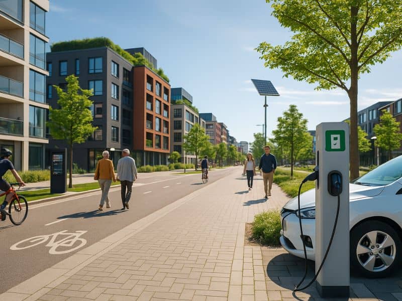
As technology, population, and the environment evolve, so does urban planning. In Colorado Springs, this includes:
- Smart city tech (EV charging, sensors)
- Climate adaptation strategies
- Flexible designs for aging populations and young families alike
Urban planning is dynamic, not static—it changes to meet tomorrow’s needs.
📍 Case in Point: Colorado Springs Urban Planning in Action
Colorado Springs’ long-term planning effort, PlanCOS, outlines how the city will grow through 2040. Current priorities include:
- More mixed-use districts
- Revitalizing the Downtown and Southwest corridors
- Protecting scenic views and parks
- Connecting new neighborhoods to transit and infrastructure
It’s a clear vision with strong community input and real goals.
🧠 What You Can Do as a Homeowner or Resident
Urban planning affects where you live, drive, shop, and play. Here’s how to stay involved:
- Check the city’s zoning map before buying or building
- Attend planning commission meetings
- Follow PlanCOS updates online
- Comment on proposed changes to your neighborhood
Your voice can shape your block—and your city.
🌆 The Future of Neighborhoods in Colorado Springs
The future looks smart, walkable, and connected. Think:
- Town centers with shops, parks, and housing all-in-one
- Bike paths linking neighborhoods
- Communities that are inclusive and affordable for all
Urban planning makes this possible, one decision at a time.
✅ Why Urban Planning in Colorado Springs Matters
Urban planning in Colorado Springs is building the foundation for vibrant, functional neighborhoods. It’s more than just blueprints—it’s a vision for how we live, connect, and grow together.
Whether you’re a homeowner, developer, or just someone who cares about your city’s future, now is the time to get involved. The neighborhoods of tomorrow are being designed today.
💬 FAQs
1. What does urban planning involve in Colorado Springs?
It includes zoning, transportation, housing, infrastructure, and community input.
2. What is PlanCOS?
PlanCOS is the official comprehensive plan guiding growth and development in Colorado Springs.
3. How can I find out my home’s zoning designation?
Visit the Colorado Springs zoning map online or contact the planning department.
4. Does urban planning help reduce traffic?
Yes, by designing smarter street layouts and encouraging public transit and biking.
5. Can residents help shape urban planning decisions?
Absolutely! You can attend city meetings, respond to surveys, or speak at public hearings.
6. What is mixed-use development?
It’s a planning style that combines housing, shops, and offices in walkable areas.

