Fence placement is one of those decisions that seems obvious—until it isn’t. What looks like a clear edge in your yard may not reflect the actual property line, and that gap between assumption and reality is where most problems begin. This is why many homeowners turn to a surveyor for fence installation before any work starts, especially in Denver where lot layouts and regulations can vary more than expected.
Local requirements can also influence how and where a fence can be built. In Denver, factors like fence height, location, and property context can affect what’s allowed, and Colorado law requires that land surveying be handled by a licensed professional. That makes verified boundary information a critical starting point, rather than relying on existing fences or visual estimates.
Why fence projects go wrong before installation begins
Fence issues usually do not begin with bad materials or poor workmanship. They begin with assumptions. A homeowner may assume the existing fence marks the line. A contractor may work from rough measurements. A neighbor may point to a long-used yard edge and say that is where the boundary sits.
Those assumptions can create problems fast. A fence that looks fine from the house may sit too close to the line, cross it, or create a new disagreement once construction starts. In some cases, the problem is not a neighbor dispute at all. It is simply that the owner never had a clear, current understanding of the parcel before planning the work.
That is why a boundary survey matters before installation instead of after. It confirms what is based on survey evidence, not memory, appearance, or convenience.
What a boundary survey actually confirms
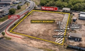
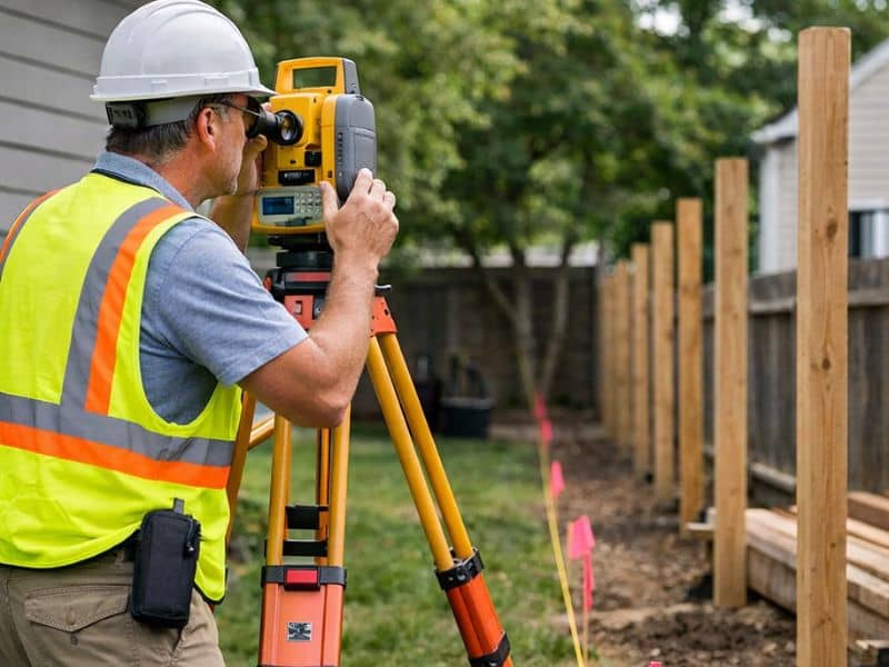
A boundary survey does more than place a few flags in the yard. It helps establish where the legal property lines can be identified on the ground using records, fieldwork, and professional judgment. For a fence project, that clarity is the starting point for every other decision.
It can confirm:
- where the boundary line is located on the site
- whether visible features match the legal line
- whether an old fence reflects the true boundary
- whether nearby improvements appear to cross the line
- where the owner has room to place a new fence
This is especially useful when the lot has older improvements, unclear corners, or visible features that may have shifted over time. Denver’s own survey FAQ explains that Colorado law requires a licensed surveyor to take legal responsibility for the land survey, which is a reminder that boundary location is not something homeowners should treat as guesswork.
How a survey helps with fence placement decisions
Once the boundary is clearly understood, planning a fence becomes much more straightforward. Instead of relying on rough measurements or existing markers, homeowners can make decisions based on accurate information about their property.
This is especially important when considering placement, spacing, and how the fence will interact with features like driveways, landscaping, or neighboring structures. Small misjudgments can lead to adjustments later, which often means added time and cost.
For many homeowners, it helps to get expert guidance on your property boundaries before finalizing a fence layout. With the right insight early on, it becomes easier to choose a location that works with both the property and the intended design.
Taking this step upfront allows the project to move forward with fewer surprises, helping ensure the fence is placed correctly from the start.
Why Denver homeowners should verify lines before building
Denver adds another layer to the decision because fence rules are tied to location and height. The city says fences shorter than 4 feet generally do not require a permit unless the site has landmark or historic status. Denver’s landmark guidance also says front-yard fences in historic areas may not be higher than 4 feet and must be more than 50% open, while rear-yard fences may not be higher than 6 feet and may be solid. Those details show why owners should not treat fence projects as one-size-fits-all improvements.
A homeowner may focus on style, privacy, or cost, but the smarter starting point is the lot itself. Before choosing materials or scheduling labor, it helps to confirm that the planned fence location fits the property and the project conditions. That is where property line verification before fencing becomes more than a precaution. It becomes part of planning the job correctly from the beginning.
In neighborhoods with older lots, additions, alleys, or corner conditions, this step can be even more important. A yard may appear straightforward until the actual boundary is measured and marked.
What to do before scheduling fence installation
Before you order materials or lock in an installer, take a step back and confirm what the site supports. That means checking local fence requirements and making sure your line location is based on current, reliable information.
For many owners, the best place to start is with professional land surveying services that can identify the boundary and help reduce confusion before the project moves forward. This is not just about avoiding conflict. It is about making better decisions while the project is still easy to adjust.
It is also wise to think beyond the fence itself. Gates, landscaping, grade changes, and access paths all work better when the line is clearly understood. A project that begins with good information usually moves more smoothly because fewer decisions need to be corrected later.
That is why a boundary survey for fence installation is such a practical step. It helps owners move forward with more confidence, gives installers clearer direction, and reduces the chance that a simple fence project turns into a costly fix. In a city like Denver, where property context and fence rules can affect what gets built, clear boundary information is one of the smartest things to confirm before the first post hole is dug.