Buying a home in Colorado with a beautiful view can feel like a dream come true. Maybe it’s the Rocky Mountains in the distance or a quiet meadow just past your fence. But sometimes, a boundary survey shows that part of what you thought was yours actually belongs to someone else. That discovery can change your plans, your budget, and even your view.
When a Boundary Survey Changes the Story in Colorado
In scenic parts of Colorado, a property’s value often comes from more than just the house—it’s the surroundings that make it special. But property lines don’t always match what you see. Maybe a fence has been in place for decades, or a row of trees “feels” like the edge of the yard.
One couple learned this the hard way. After buying a home with a perfect mountain view, they planned to extend their deck. A boundary survey in Colorado showed the deck’s corner would cross into the neighbor’s yard by a few feet. That small detail forced them to change the entire project.
Why Boundary Survey Surprises Happen in Colorado
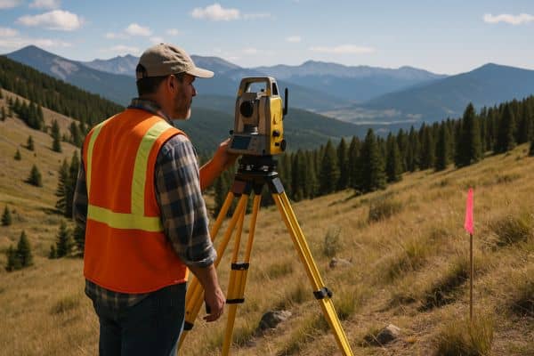
Colorado’s mix of old neighborhoods, rural plots, and newer developments can make boundaries tricky. Some property lines follow hills or creeks, which can change over time. Older maps may not be as accurate, leaving gaps between what’s recorded and what’s on the ground.
In rural and foothill areas, irregular lot shapes are common. The perfect spot you’ve picked for a patio, fire pit, or garden might technically be outside your property.
The True Cost of Boundary Survey Mistakes
Finding out too late that you’ve built over the line isn’t just inconvenient—it can be expensive. In some cases, you might have to move or remove the structure. You could face legal disputes or lose access to part of your yard.
Even without a lawsuit, a boundary issue can delay construction, add redesign costs, and strain relationships with neighbors. In Colorado’s competitive real estate market, it can also hurt your property value.
Protect Your View with a Boundary Survey Before You Buy
If you’re shopping for property in Colorado—especially one with scenic views—make sure a boundary survey is part of your due diligence. Having a licensed land surveyor in Colorado check the exact property lines before closing can save you from unpleasant surprises.
Ask your real estate agent or title company to compare the survey results with the property description in your deed. If something doesn’t match, it’s better to know before you commit to the purchase or start a big project.
A Boundary Survey Tip for Colorado Homeowners
Even if you’ve owned your home for years, don’t assume the boundaries are obvious. Fences can be in the wrong spot, and landscaping can hide the true line. A boundary survey in Colorado isn’t just for new buyers—it’s also smart before building, putting up a fence, or doing landscaping near the edge of your property.
In a state where the land itself is part of the appeal, knowing your boundaries protects both your home and the reasons you fell in love with it.
Keep Your View, Keep Your Peace
That dream view of the Rockies is worth protecting—and a boundary survey in Colorado makes sure it stays yours. Knowing exactly where your property begins and ends helps you avoid disputes, keep your projects on track, and protect your home’s value. If you’re buying or planning changes to your land, getting a boundary survey in Colorado early in the process will give you the confidence to move forward without costly surprises.
FAQs
1. Can a boundary survey affect my property’s view?
Yes. If part of the land with your scenic view isn’t legally yours, a boundary survey can reveal that—and it may affect what you can build or plant.
2. Are property lines in hilly Colorado areas harder to define?
Absolutely. Slopes, creeks, and irregular terrain can make property boundaries less obvious. A boundary survey ensures the legal lines match the land’s shape.
3. Should I get a boundary survey before building a deck or patio?
Yes. Even a small structure that crosses the property line can lead to disputes or costly changes later.
4. Can a boundary survey increase property value?
In competitive markets like Colorado, having a recent, accurate survey can give buyers confidence—especially for scenic or high-value lots.
